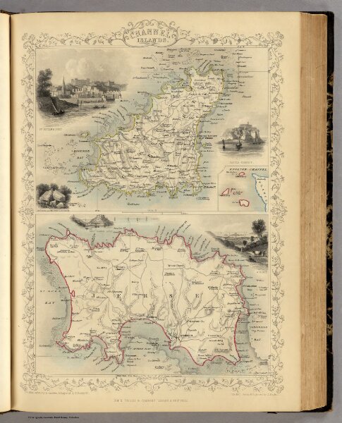
Channel Islands. (with) inset map of the English Channel.
Identifier
0466.011
Collection
pilot3
Description
Channel Islands. (with) inset map of the English Channel. The Illustrations by H. Winkles & Engraved by E. Radclyffe. The Map Drawn & Engraved by J. Rapkin.