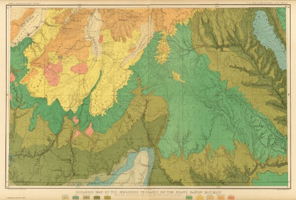
Geologic Map Of The Mesozoic Terraces Of The Grand Canon District.
Identifier
4713.023
Collection
pilot3
Description
Geologic Map Of The Mesozoic Terraces Of The Grand Canon District And The Southern Portions Of The High Plateaus. Atlas Sheet XXI. Geology by C.E. Dutton. Julius Bien & Co. lith. U.S. Geological Survey, Geology of the Grand Canon District.