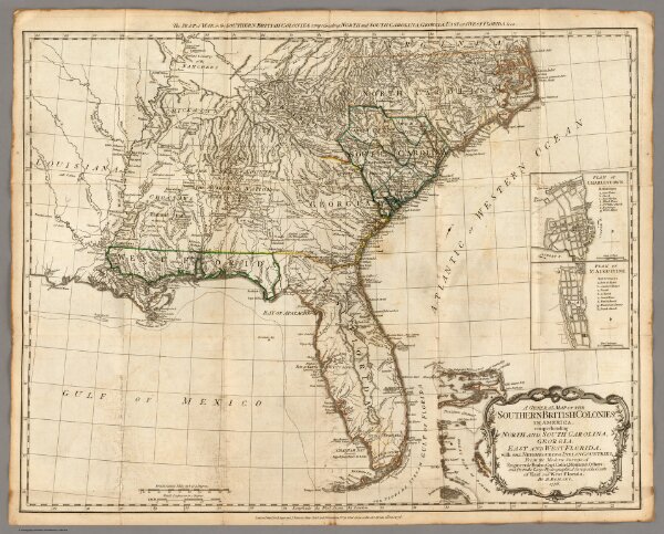
A General Map of the Southern British Colonies, in America.
Identifier
0875.005
Collection
pilot4
Description
A General Map of the Southern British Colonies, in America. containing North and South Carolina, Georgia, East and West Florida, with the Neighbouring Indian Countries. From the Modern Surveys of Engineer de Brahm, Capt. Collet, Mouzon & Others; and from the Large Hydrographical Survey of the Coasts of East and West Florida. By B. Romans, 1776. (with) Plan of Charleston and ... St. Augustine. London: Printed for R. Sayer & J. Bennett ... 15th Octr. 1776.