David Rumsey
ArcGIS, QGIS or web apps can simply use this map with web map services. WMTS, TileJSON or XYZ tiles are provided for quick access to processed maps.
Sign in to get links.
Sign in to download GeoTIFF.
Overlay & compare
iiif viewer, iiif info json
Website
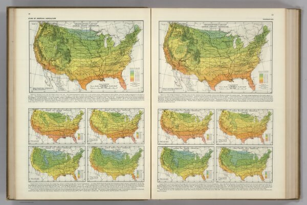
Monthly Temperature Maps: January. February. Atlas of American Agriculture.
5797.013
pilot4
(Monthly Temperature Maps:) January. February. Atlas of American Agriculture. FJM.
1928
1936
Kincer, Joseph Burton
U.S. Department of Agriculture
62 × 48 cm