David Rumsey
ArcGIS, QGIS or web apps can simply use this map with web map services. WMTS, TileJSON or XYZ tiles are provided for quick access to processed maps.
Sign in to get links.
Sign in to download GeoTIFF.
Overlay & compare
iiif viewer, iiif info json
Website
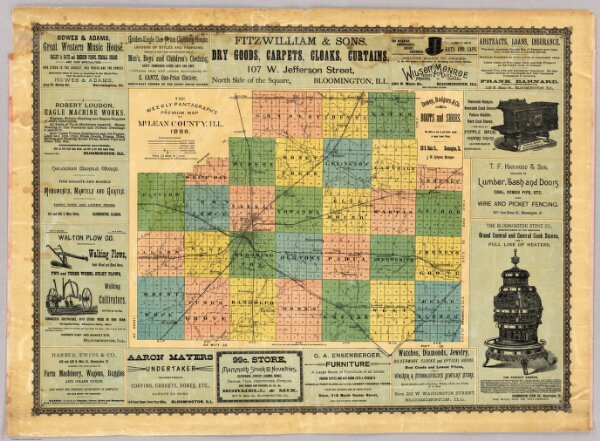
Map Of McLean County, Ill. 1886.
3717.000
pilot3
The Weekly Pantagraph's Premium Map Of McLean County, Ill. 1886. Copyrighted & Published By J.S. Hambaugh, Chicago. Geo. P. Ela, Civil And Drainage Engineer, Bloomington, Ill.
1886
Weekly Pantagraph
J.S. Hambaugh
85 × 61 cm
1 : 158400