David Rumsey
ArcGIS, QGIS or web apps can simply use this map with web map services. WMTS, TileJSON or XYZ tiles are provided for quick access to processed maps.
Sign in to get links.
Sign in to download GeoTIFF.
Overlay & compare
iiif viewer, iiif info json
Website
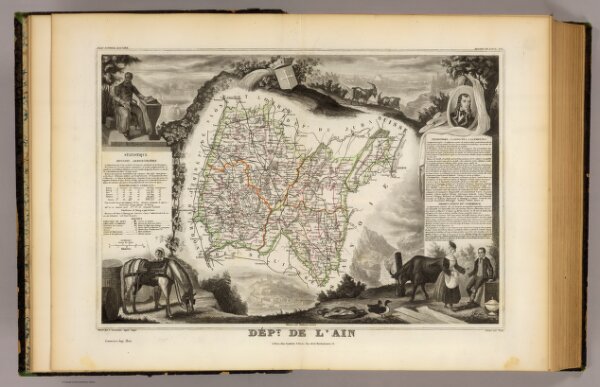
Dept. De L'Ain.
0427.001
pilot2
Dept. De L'Ain. Atlas National Illustre. Region de L'Est. No. 1. Illustre par Bonheur, peintre. Dresse par V. Levasseur, Ingenr. Geogr., Grave par Piat. Lemercier Imp. Paris. A Paris, chez Combette, Editeur, Rue de la Parcheminerie, 15. (1856)
1856
Levasseur, Victor.
A. Combette
42 × 31 cm
1 : 580000