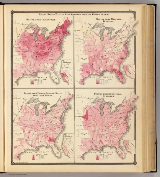
United States vitality maps. Compiled from the Census of 1870.
Identifier
0936.007
Collection
pilot4
Description
United States vitality maps. Compiled from the Census of 1870. Deaths from consumption. Deaths from malarial diseases, deaths from enteric, cerebro-spinal and typhus fevers. Deaths from intestinal diseases. Copyright 1877, by Syder Van Vechten & Co. (Compiled and published by Snyder, Van Vechten & Co., Milwaukee. 1878)