David Rumsey
ArcGIS, QGIS or web apps can simply use this map with web map services. WMTS, TileJSON or XYZ tiles are provided for quick access to processed maps.
Sign in to get links.
Sign in to download GeoTIFF.
Overlay & compare
iiif viewer, iiif info json
Website
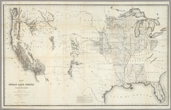
Map of the Public Land States And Territories
4581.000
pilot2
Map of the Public Land States And Territories constructed from The Public Surveys and other official sources in the General Land Office. Drawn by J.H. Hawes, Principal Draughtsman. T. Franks, Assistant. 1864. Engraved by D. McClelland Washn. D.C.
1864
Hawes, J.H.
U.S.
114 × 70 cm
1 : 3801600