David Rumsey
ArcGIS, QGIS or web apps can simply use this map with web map services. WMTS, TileJSON or XYZ tiles are provided for quick access to processed maps.
Sign in to get links.
Sign in to download GeoTIFF.
Overlay & compare
iiif viewer, iiif info json
Website
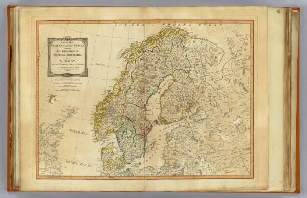
Northern States.
2310.047
pilot4
A new map of the Northern States containing the kingdoms of Sweden, Denmark, and Norway; with the western parts of Russia, Livonia, Courland & ca. London, Published 12 May 1794, by Laurie & Whittle, Fleet Street.
1794
1804
Robert Laurie & James Whittle
Laurie & Whittle
65 × 47 cm
1 : 4400000