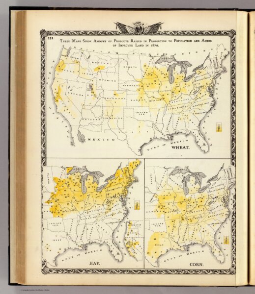
Products raised in proportion to population and acres of improved land in 1870. Wheat. Hay. Corn.
ArcGIS, QGIS or web apps can simply
use this map with web map services.
WMTS, TileJSON or XYZ tiles
are provided for quick access to processed maps.
Sign in to get links.