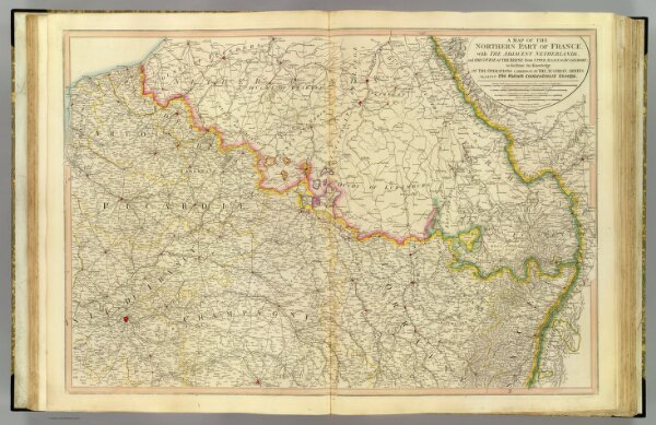
A map of the northern part of France, with the adjacent Netherlands, and the course of the Rhine from Upper Alsace to Dusseldorf; to facilitate the knowledge of the operations carried on by the Austrian armies against the French conventional troops. London: printed for W. Faden, Geographer to the King, and to H.R.H. the Prince of Wales. Charing Cross, Dec. 21, 1795. Engraved by B. Baker, Islington.