David Rumsey
ArcGIS, QGIS or web apps can simply use this map with web map services. WMTS, TileJSON or XYZ tiles are provided for quick access to processed maps.
Sign in to get links.
Sign in to download GeoTIFF.
Overlay & compare
iiif viewer, iiif info json
Website
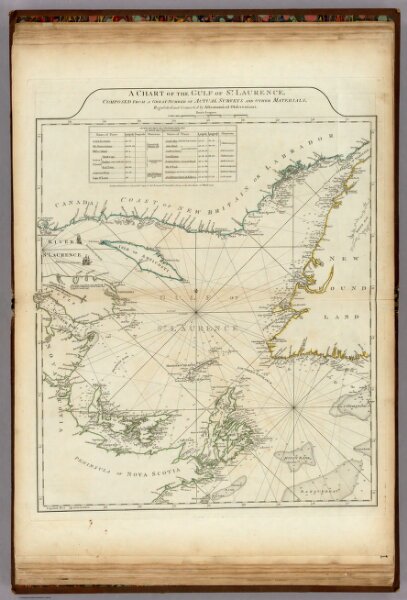
A Chart Of The Gulf Of St. Laurence.
0346.012
pilot2
A Chart Of The Gulf Of St. Laurence, Composed From A Great Number Of Actual Surveys And Other Materials, Regulated and Connected by Astronomical Observations. London. Printed & Sold by Robt. Sayer & Jn. Bennett ... 25th March 1775.
1776
Jefferys, Thomas
Sayer and Bennett
50 × 61 cm
1 : 1480000