David Rumsey
ArcGIS, QGIS or web apps can simply use this map with web map services. WMTS, TileJSON or XYZ tiles are provided for quick access to processed maps.
Sign in to get links.
Sign in to download GeoTIFF.
Overlay & compare
iiif viewer, iiif info json
Website
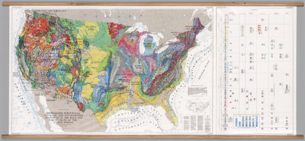
United States -- Geology: Physiographic & Structural Provinces
7130.000
pilot2
Generalized Structural Lithographic and Physiographic Provinces in the Fold and Thrust Belts of the United States, (exclusive of Alaska and Hawaii).
1983
Bayer, Kenneth C.
United States Geological Survey (USGS)
276 × 123 cm
1 : 2500000