David Rumsey
ArcGIS, QGIS or web apps can simply use this map with web map services. WMTS, TileJSON or XYZ tiles are provided for quick access to processed maps.
Sign in to get links.
Sign in to download GeoTIFF.
Overlay & compare
iiif viewer, iiif info json
Website
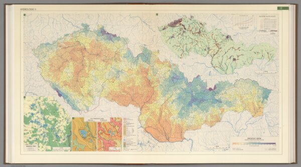
Hydrology II.
6385.049
pilot2
1966
Czechoslovakia. Ústřední správa geodézie a kartografie.
88 × 51 cm
1 : 1000000