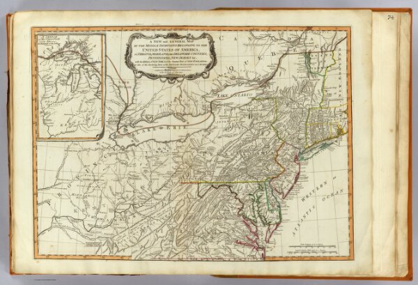
A new and general map of the middle dominions belonging to the United States of America, viz. Virginia, Maryland, the Delaware-Counties, Pennsylvania, New Jersey &c., with the addition of New York, & of the greatest part of New England &c., as also of the bordering parts of the British possessions in Canada. (with) A sketch of the upper parts to shown the remainder of the lakes. London, Published by Laurie & Whittle, No. 53, Fleet Street, as the act directs 12th May, 1794.