David Rumsey
ArcGIS, QGIS or web apps can simply use this map with web map services. WMTS, TileJSON or XYZ tiles are provided for quick access to processed maps.
Sign in to get links.
Sign in to download GeoTIFF.
Overlay & compare
iiif viewer, iiif info json
Website
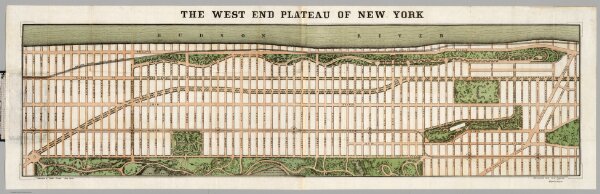
The West End Plateau Of The City Of New York
2556.003
pilot2
The West End Plateau Of The City Of New York. By Egbert L. Viele. (to accompany) The West End Plateau Of New York. Herman K. Viele Civil Engineer & City Surveyor. Johnson & Pratt Print. New York.
1879
Viele, Egbert L.
Johnson & Pratt
118 × 33 cm