David Rumsey
ArcGIS, QGIS or web apps can simply use this map with web map services. WMTS, TileJSON or XYZ tiles are provided for quick access to processed maps.
Sign in to get links.
Sign in to download GeoTIFF.
Overlay & compare
iiif viewer, iiif info json
Website
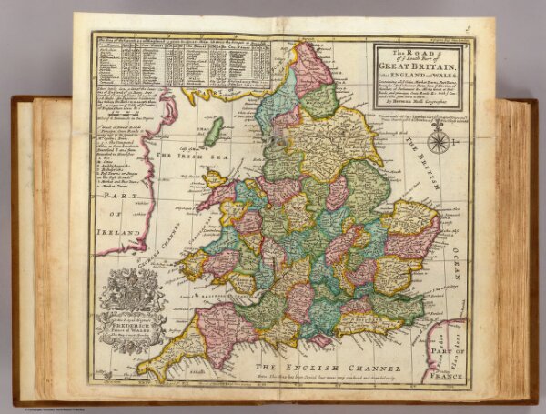
The roads of England and Wales.
5580.009
pilot4
The roads of ye south part of Great Britain, called England and Wales ... By Herman Moll Geographer. Printed and sold by T. Bowles next ye Chapter House in St. Pauls Churchyard, & I. Bowles at ye Black Horse in Cornhill (1736?)
1736
Moll, Herman, d. 1732
Thos. Bowles and John Bowles
31 × 29 cm
1 : 2400000