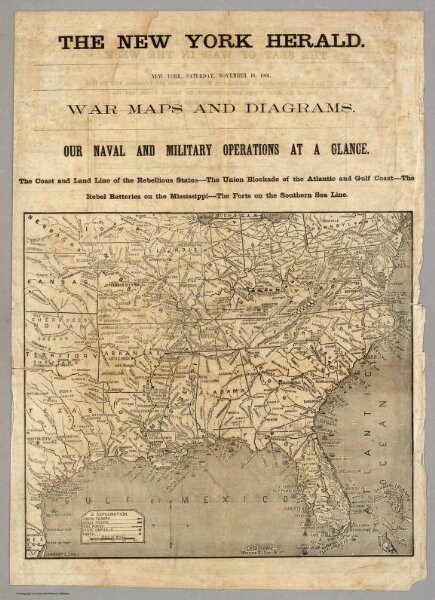
War Maps And Diagrams. Our Naval And Military Operations At A Glance.
Identifier
5472.001
Collection
pilot4
Description
War Maps And Diagrams. Our Naval And Military Operations At A Glance. The Coast and Land Line of the Rebellious States ... The Union Blockade of the Atlantic and Gulf Coast ... The Rebel Batteries on the Mississippi ... The Forts on the Southern Sea Line. The New York Herald. New York. Saturday, November 16, 1861. (with) 17 additional maps.