David Rumsey
ArcGIS, QGIS or web apps can simply use this map with web map services. WMTS, TileJSON or XYZ tiles are provided for quick access to processed maps.
Sign in to get links.
Sign in to download GeoTIFF.
Overlay & compare
iiif viewer, iiif info json
Website
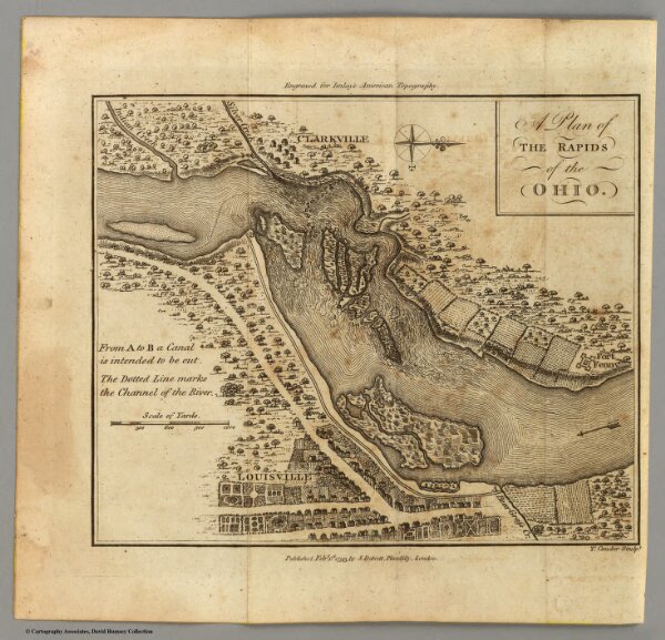
Rapids of the Ohio.
2757.002
pilot3
A Plan of the Rapids of the Ohio. T. Conder, Sculpt. Engraved for Imlay's American Topography. Published Feby. 1st, 1793, by J. Debrett, Piccadilly, London.
1797
Imlay, Gilbert
J. Debrett
19 × 16 cm
1 : 26991