David Rumsey
ArcGIS, QGIS or web apps can simply use this map with web map services. WMTS, TileJSON or XYZ tiles are provided for quick access to processed maps.
Sign in to get links.
Sign in to download GeoTIFF.
Overlay & compare
iiif viewer, iiif info json
Website
Wisconsin Sectional Map
5208.002
missinglocation
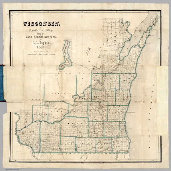
Wisconsin, a Sectional Map With the Most Recent Surveys, by I.A. Lapham, 1846. Scale, 10 miles to an inch. Published by P.C. Hale, Milwaukee, Wisconsin. J.H. Bufford & Cos Lithog Boston. Entered ... 1846 by P.C. Hale ... Territory of Wisconsin.
1846
Lapham, I.A.
P.C. Hale
57 × 58 cm
1 : 633600