David Rumsey
ArcGIS, QGIS or web apps can simply use this map with web map services. WMTS, TileJSON or XYZ tiles are provided for quick access to processed maps.
Sign in to get links.
Sign in to download GeoTIFF.
Overlay & compare
iiif viewer, iiif info json
Website
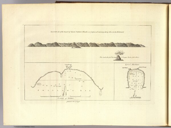
Queen Charlotte's Islands.
3403.014
default
The north side of the largest of Queen Charlotte's Islands as it appeared running along shore to the westward. Publish'd Novr. 1st, 1772. (London: printed for W. Strahan; and T. Cadell in the Strand, MDCCLXXIII).
1773
Hawkesworth, John, 1715?-1773
W. Strahan and T. Cadell
29 × 17 cm