David Rumsey
ArcGIS, QGIS or web apps can simply use this map with web map services. WMTS, TileJSON or XYZ tiles are provided for quick access to processed maps.
Sign in to get links.
Sign in to download GeoTIFF.
Overlay & compare
iiif viewer, iiif info json
Website
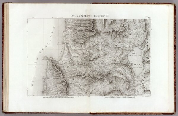
46 Cesaree.
3964.052
pilot3
(Carte topographique de l'Egypte et de plusieurs parties des pays limitrophes ...) Flle. 46. Acre, Nazareth, Le Jourdain. Leve par M. Jacotin. Jacotin dirt. [1826]
1826
Jacotin, Pierre, 1765-1827
C.L.F. Panckoucke
81 × 54 cm
1 : 100000