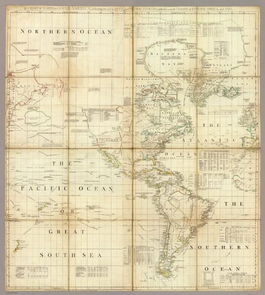
A chart of North and South America including the Atlantic and Pacific Oceans, with the nearest coasts of Europe, Africa and Asia (by John Green]. Publish'd according to Act of Parliament Feb. 19, 1753, by T. Jefferys, Geographer to his Royal Highness the Prince of Wales at the Corner of St. Martins Lane Charing Cross ...