David Rumsey
ArcGIS, QGIS or web apps can simply use this map with web map services. WMTS, TileJSON or XYZ tiles are provided for quick access to processed maps.
Sign in to get links.
Sign in to download GeoTIFF.
Overlay & compare
iiif viewer, iiif info json
Website
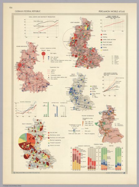
German Federal Republic. Pergamon World Atlas.
0737.073
pilot4
German Federal Republic. Pergamon World Atlas. Pergamon Press, Ltd. & P.W.N. Poland 1964. Sluzba Topograficzna W.P.
1964
1968
Polish Army Topography Service
Pergamon Press
28 × 40 cm