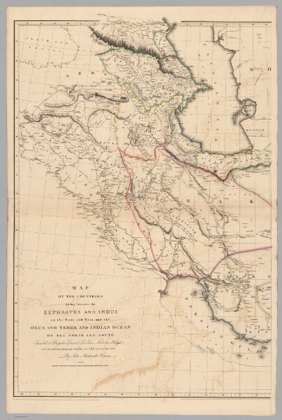
Upper Sheet: Map of the Countries lying between the Euphrates and Indus
Identifier
6914.001
Collection
missinglocation
Description
(Upper Sheet to) Map of the Countries lying between the Euphrates and Indus on the East and West, and the Oxus and Terek and Indian Ocean on the North and South. Inscribed to Brigadier General Sir John Malcolm Knight of the Royal Persian Order of the Lion and Sun By John Macdonald Kinneir. Published, A. Arrowsmith No. 10 Soho Square Hydrographer to H.R.H., 1st January 1813.