David Rumsey
ArcGIS, QGIS or web apps can simply use this map with web map services. WMTS, TileJSON or XYZ tiles are provided for quick access to processed maps.
Sign in to get links.
Sign in to download GeoTIFF.
Overlay & compare
iiif viewer, iiif info json
Website
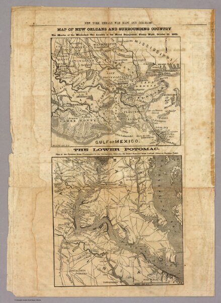
Map of New Orleans and Surrounding Country.
5472.006
pilot4
Map of New Orleans and Surrounding Country. (with) The Lower Potomac. New York Herald War Maps and Diagrams. (Page) 8.
1861
New York Herald
37 × 52 cm