David Rumsey
ArcGIS, QGIS or web apps can simply use this map with web map services. WMTS, TileJSON or XYZ tiles are provided for quick access to processed maps.
Sign in to get links.
Sign in to download GeoTIFF.
Overlay & compare
iiif viewer, iiif info json
Website
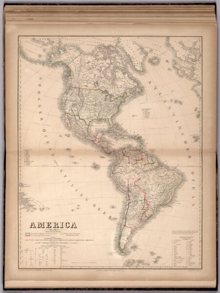
America
2595.063
pilot2
America. Bearbeitet und gezeichnet von H. Kiepert. Revidirt v. C. Graf, 1865. Gestochen v. C. Jungmann. Weimar: Geographisches Institut. (to accompany) Hand - Atlas Der Erde Und Des Himmels.
1865
1867
Graf, Carl
Weimar Geographisches Institut
51 × 65 cm
1 : 26000000