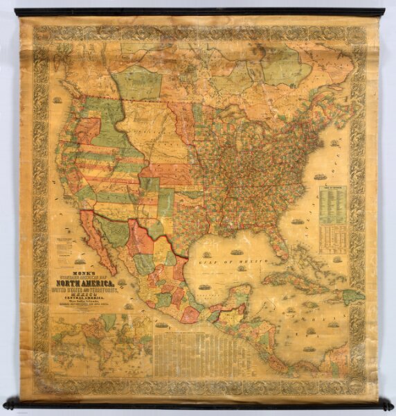
Monk's Standard American Map Exhibiting the larger portion of North America; Embracing The United States And Territories, Mexico, And Central America, Including The West India Islands, The Canadas, New Brunswick And Nova Scotia. Compiled from recent Government surveys and other authentic sources. Baltimore. Drawn, Engraved & Printed by A. Hoen & Co. Second street. Published by Jacob Monk. 1859. (inset) New Map Of The World on Mercators Projection ...