David Rumsey
ArcGIS, QGIS or web apps can simply use this map with web map services. WMTS, TileJSON or XYZ tiles are provided for quick access to processed maps.
Sign in to get links.
Sign in to download GeoTIFF.
Overlay & compare
iiif viewer, iiif info json
Website
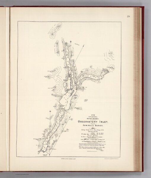
Facsimile: Observatory Inlet - Admiralty Survey.
0009.025
pilot3
(Facsimile) No. XI. N.W. America. British Columbia. Observatory Inlet, from the Admiralty Survey, of 1868. (Reduced from the original scale). Photo. Lith. by A. Hoen & Co. Baltimore, MD.
1868
1904
British Admiralty
(U.S.) Government Printing Office
34 × 43 cm
1 : 223000