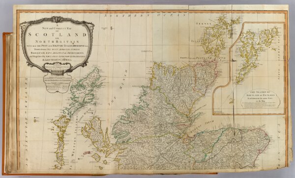
A new and correct map of Scotland or North Britain with all the post and military roads, divisions & ca. (North half). Drawn from the most approved surveys, illustrated with many additional improvements, and regulated by the latest astronomical observations by Lieutenant Campbell. (with) The islands of Shetland or Zetland, laid down on the same scale as the map. London, Published by Laurie & Whittle, No. 53 Fleet Street, as the act directs 12th May 1794.