David Rumsey
ArcGIS, QGIS or web apps can simply use this map with web map services. WMTS, TileJSON or XYZ tiles are provided for quick access to processed maps.
Sign in to get links.
Sign in to download GeoTIFF.
Overlay & compare
iiif viewer, iiif info json
Website
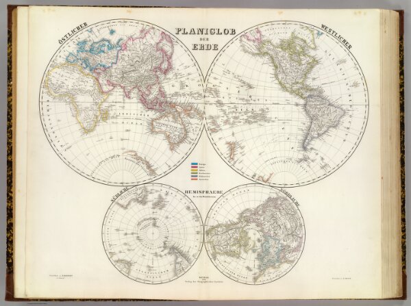
Planiglob der Erde.
2077.001
pilot4
Planiglob der Erde. Ostlicher. Westlicher. Sudliche, Nordliche Hemisphaere bis zu den Wendekreisen. Gezeichnet von H. Kiepert u C. Ohmann. Gestochen von E. Kratz. Weimar, 1856, Verlag des Geographischen Instituts.
1856
Kiepert, Heinrich, 1818-1899
Weimar Geo Inst.
66 × 51 cm
1 : 80000000