David Rumsey
ArcGIS, QGIS or web apps can simply use this map with web map services. WMTS, TileJSON or XYZ tiles are provided for quick access to processed maps.
Sign in to get links.
Sign in to download GeoTIFF.
Overlay & compare
iiif viewer, iiif info json
Website
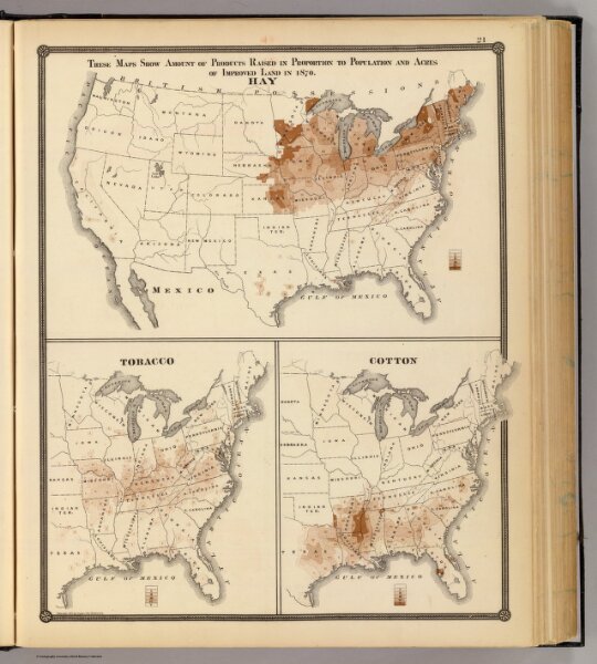
Products raised in 1870. Hay. Tobacco. Cotton.
0936.014
pilot4
These maps show amount of products raised in proportion to population and acres of improved land in 1870. Hay. Tobacco. Cotton. Copyright 1877, by Syder Van Vechten & Co. (Compiled and published by Snyder, Van Vechten & Co., Milwaukee. 1878)
1878
Snyder, Van Vechten & Co.
34 × 42 cm
1 : 17700000