David Rumsey
ArcGIS, QGIS or web apps can simply use this map with web map services. WMTS, TileJSON or XYZ tiles are provided for quick access to processed maps.
Sign in to get links.
Sign in to download GeoTIFF.
Overlay & compare
iiif viewer, iiif info json
Website
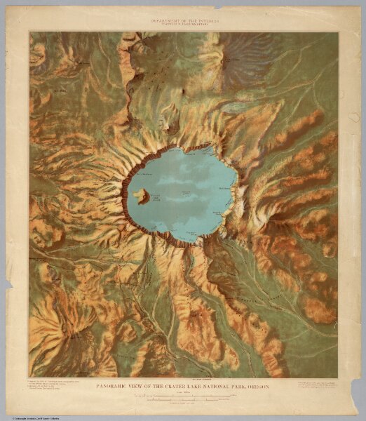
Panoramic View of the Crater Lake National Park.
6087.000
pilot
1915
John H. Renshawe
USGS (U.S. Geological Survey)
49 × 56 cm
1 : 62500