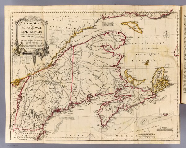
A new map of Nova Scotia and Cape Britain, with the adjacent parts of New England and Canada, composed from a great number of actual surveys, and other materials regulated by many new astronomical observations of the longitude as well as latitude; with an explanation. 1755 published according to Act of Parliament by Thos. Jefferys, Geographer to His Royal Highness the Prince of Wales at the corner of St. Martins Lane, Charing Cross, London. (1760)