David Rumsey
ArcGIS, QGIS or web apps can simply use this map with web map services. WMTS, TileJSON or XYZ tiles are provided for quick access to processed maps.
Sign in to get links.
Sign in to download GeoTIFF.
Overlay & compare
iiif viewer, iiif info json
Website
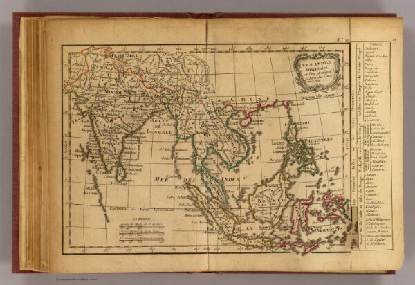
Les Indes Orientales.
0421.018
pilot2
Les Indes Orientales et leur archipel. A Paris, ches Lattre. Avec priv. (ca. 1800)
1800
Lattre, Jean
C.F. Delamarche
29 × 19 cm
1 : 29000000