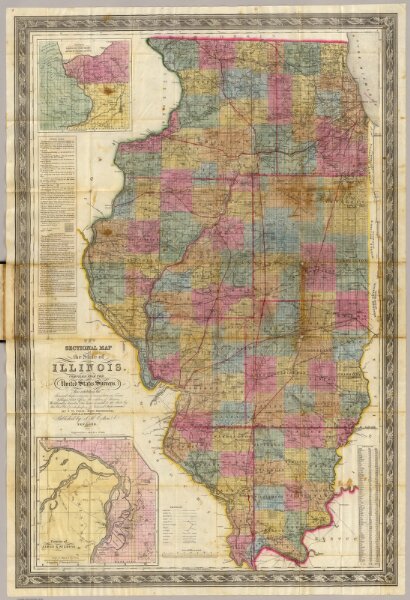
New sectional map of the state of Illinois. Compiled from the United States surveys. Also exhibiting the internal improvements, distances between towns, villages & post offices, the outlines of prairies, woodlands, marshes & the lands donated to the state by the Gen. Govt. for the purpose of internal improvements. By J.M. Peck, John Messinger, and A.J. Mathewson. Published by J.H. Colton & Co. New-York. 1852. Engraved by S. Stiles & Co. N. York. Entered ... 1836 by J.H. Colton & Co. ... New York. (inset) Vicinity of Alton & St. Louis. (inset) Vicinity of Galena, the Lead Region and part of Wisconsin and Iowa.