David Rumsey
ArcGIS, QGIS or web apps can simply use this map with web map services. WMTS, TileJSON or XYZ tiles are provided for quick access to processed maps.
Sign in to get links.
Sign in to download GeoTIFF.
Overlay & compare
iiif viewer, iiif info json
Website
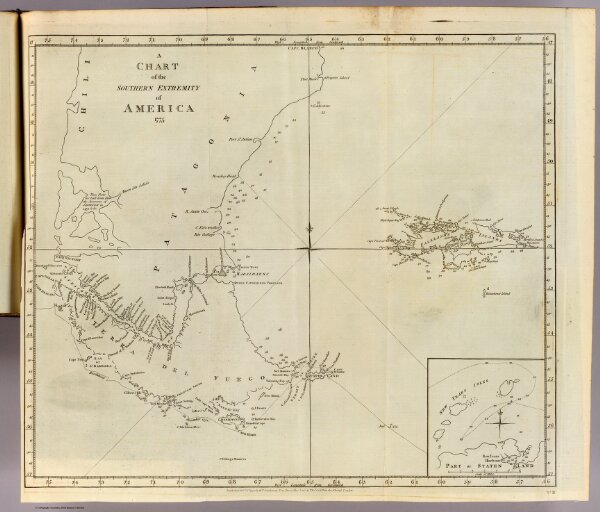
S. extremity of America.
3404.062
pilot4
A chart of the southern extremity of America 1775. (with) Part of Staten Land. No. II. Published Febry. 1st, 1777 by Wm. Strahan in New Street, Shoe Lane & Thos. Cadell in the Strand, London.
1777
Cook, James, 1728-1779
W. Strahan and T. Cadell
51 × 44 cm
1 : 4500000