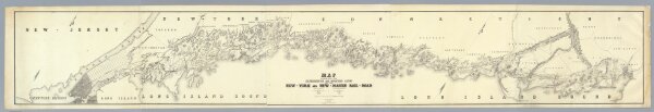
Map Exhibiting The ... Lines for the New-York and New-Haven Rail-Road.
Identifier
4218.000
Collection
pilot3
Description
Map Exhibiting The Experimental and Located Lines for the New-York and New-Haven Rail-Road ... Projected and Drawn by P. Anderson Civil Engr. Scale 1 to 40,000. Febr. 1845. Snyder & Black Lithogrs. 87 Fulton St. New-York.