David Rumsey
ArcGIS, QGIS or web apps can simply use this map with web map services. WMTS, TileJSON or XYZ tiles are provided for quick access to processed maps.
Sign in to get links.
Sign in to download GeoTIFF.
Overlay & compare
iiif viewer, iiif info json
Website
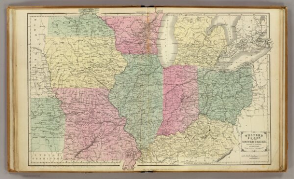
Western U.S.
0197.016
pilot4
Western division of the United States. Designed to accompany Cornell's High school geography. Drawn by E. Wells, N.Y. Entered ... 1856, by S.S. Cornell ... Southern District of New York. New York: D. Appleton & Co., 443 & 445 Broadway. (1864)
1864
Cornell, S. S. (Sarah S.)
Appleton & Co.
52 × 35 cm
1 : 3000000