David Rumsey
ArcGIS, QGIS or web apps can simply use this map with web map services. WMTS, TileJSON or XYZ tiles are provided for quick access to processed maps.
Sign in to get links.
Sign in to download GeoTIFF.
Overlay & compare
iiif viewer, iiif info json
Website
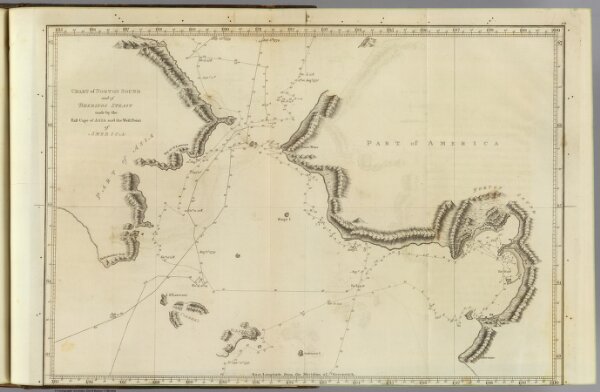
Norton Sound, Bherings Strait.
3405.016
pilot4
Chart of Norton Sound and of Bherings Strait made by the East Cape of Asia and the West Point of America. (Copied by Lieut. Henry Roberts. London, G. Nicol and T. Cadell, 1785)
1785
Cook, James, 1728-1779
G. Nicol and T. Cadell
42 × 28 cm
1 : 4400000