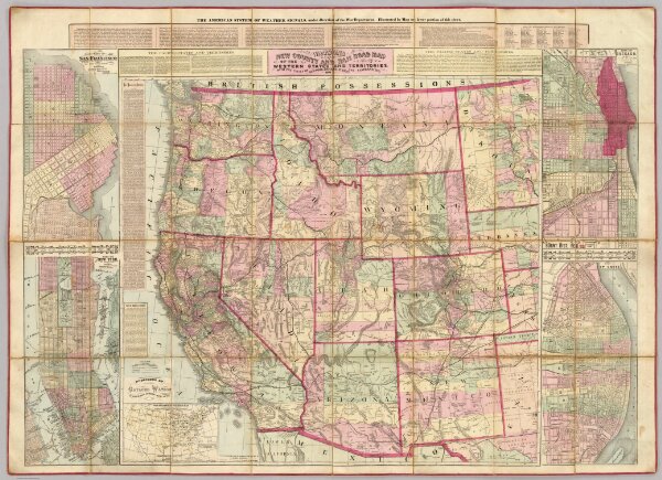
Watson's New County and Railroad Map of the Western States and Territories.
Identifier
2539.001
Collection
pilot4
Description
Watson's New County and Railroad Map of the Western States and Territories, With the Cities of New York, Chicago, St. Louis and San Francisco, 1874. Published by Gaylord Watson, 16 Beekman St., New York. Entered ... 1871, by Gaylord Watson ... Washington. (with) 5 inset maps: City of San Francisco; City of New York to 110th Street; City of Chicago; City of St. Louis; War Department Weather Map.