David Rumsey
ArcGIS, QGIS or web apps can simply use this map with web map services. WMTS, TileJSON or XYZ tiles are provided for quick access to processed maps.
Sign in to get links.
Sign in to download GeoTIFF.
Overlay & compare
iiif viewer, iiif info json
Website
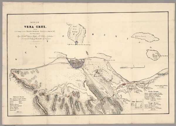
Siege Of Vera Cruz, by the U.S. Troops
3482.000
pilot
Siege Of Vera Cruz, by the U.S. Troops under Major General Scott, in March 1847, from Surveys made by Major Turnbull, Captains Hughes, McClellan & Johnston; Lieutenants Derby & Hardcastle, Topl. Engineers. Drawn by Capt. McClellan.
1847
U.S. War Department, Topographical Engineers
No publisher
64 × 40 cm
1 : 16400