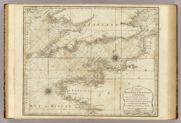
A chart of the British Channel; comprehending the southern coasts of England and Wales: from the mouth of the Thames to St. David's Head, with the coast of France from Dunkirk to the River of Nantes. By Thomas Jeffery's, Geographer to the King. London, published by Robert Sayer, no. 53 in Fleet Street, as the Act directs 20 Feby. 1787.