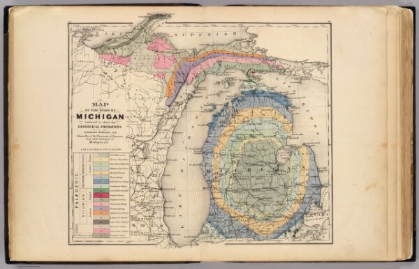
Map of the State of Michigan colored to show the geological formations.
Identifier
1147.003
Collection
pilot4
Description
Map of the State of Michigan colored to show the geological formations by Alexander Winchell, LL.D., Chancellor of the University of Syracuse, late State Geologist of Michigan, etc. (Drawn, compiled, and edited by H.F. Walling, C.E. ... Published by R.M. & S.T. Tackabury, Detroit, Mich. Entered ... 1873, by H.F. Walling ... Washington. The Claremont Manufacturing Company, Claremont, N.H., Book Manufacturers)