David Rumsey
ArcGIS, QGIS or web apps can simply use this map with web map services. WMTS, TileJSON or XYZ tiles are provided for quick access to processed maps.
Sign in to get links.
Sign in to download GeoTIFF.
Overlay & compare
iiif viewer, iiif info json
Website
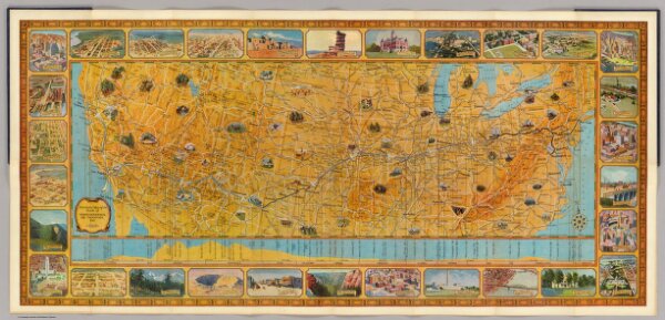
Illustrated Map of the Route of Transcontinental Air Transport, Inc.
3704.002
pilot4
Illustrated Map of the Route of Transcontinental Air Transport, Inc. TAT. Copyright, Rand McNally & Company. 7134 - New York 6-29.
1929
Transcontinental Air Transport, Inc.
78 × 36 cm
1 : 5500000