David Rumsey
ArcGIS, QGIS or web apps can simply use this map with web map services. WMTS, TileJSON or XYZ tiles are provided for quick access to processed maps.
Sign in to get links.
Sign in to download GeoTIFF.
Overlay & compare
iiif viewer, iiif info json
Website
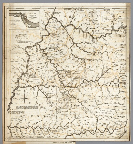
Kentucky.
0632.018
pilot4
A Map of Kentucky, Drawn from Actual Observations. By John Filson. (with) A Plan of the Rapids, in the River Ohio. Published Novr. 23, 1793, by John Stockdale, Piccadilly.
1794
Morse, Jedidiah
John Stockdale
46 × 50 cm
1 : 633600