David Rumsey
ArcGIS, QGIS or web apps can simply use this map with web map services. WMTS, TileJSON or XYZ tiles are provided for quick access to processed maps.
Sign in to get links.
Sign in to download GeoTIFF.
Overlay & compare
iiif viewer, iiif info json
Website
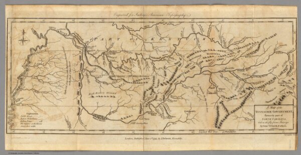
Tennassee Government.
2757.004
pilot4
A Map of the Tennassee Government, formerly part of North Carolina, taken chiefly from Surveys by Genel. D. Smith & others. T. Conder Sculpt. Engraved for Imlay's American Topography. London, Published June 1st, 1795, by J. Debrett, Piccadilly.
1797
Imlay, Gilbert
J. Debrett
41 × 18 cm
1 : 2150000