David Rumsey
ArcGIS, QGIS or web apps can simply use this map with web map services. WMTS, TileJSON or XYZ tiles are provided for quick access to processed maps.
Sign in to get links.
Sign in to download GeoTIFF.
Overlay & compare
iiif viewer, iiif info json
Website
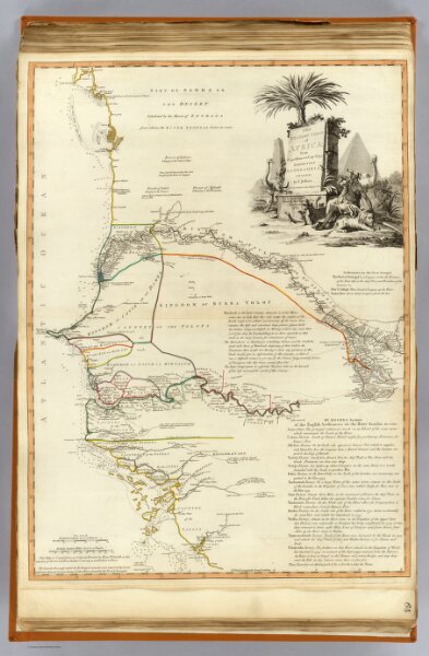
W. coast Africa.
2310.075
pilot4
The western coast of Africa from Cape Blanco to Cape Virga, exhibiting Senegambia Proper. By T. Jefferys, Geographer to his Majesty. London, Printed by Robt. Sayer, No. 53, Fleet Street, 1789.
1789
1804
Sayer, Robert
Laurie & Whittle
52 × 71 cm
1 : 1850000