David Rumsey
ArcGIS, QGIS or web apps can simply use this map with web map services. WMTS, TileJSON or XYZ tiles are provided for quick access to processed maps.
Sign in to get links.
Sign in to download GeoTIFF.
Overlay & compare
iiif viewer, iiif info json
Website
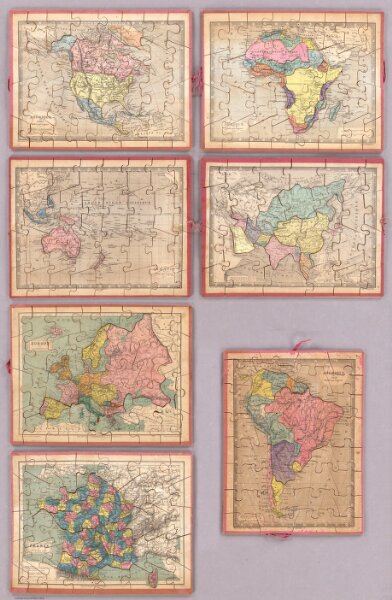
Seven Puzzle Maps of the World.
4782.001
pilot4
Amerique du Nord; Amerique du Sud; Oceanie; Afrique; Asie; Europe et ses Chemins de fer; France et ses Chemins de fer.
1850
Logerot
Mon. Logerot
29 × 23 cm