David Rumsey
ArcGIS, QGIS or web apps can simply use this map with web map services. WMTS, TileJSON or XYZ tiles are provided for quick access to processed maps.
Sign in to get links.
Sign in to download GeoTIFF.
Overlay & compare
iiif viewer, iiif info json
Website
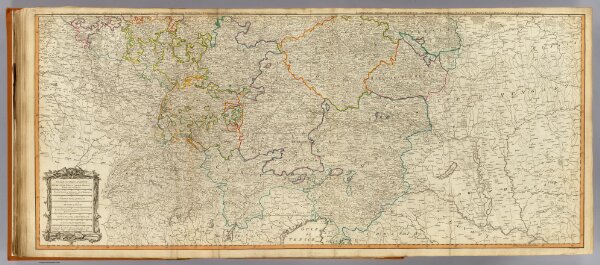
Germany (south)
2310.039
pilot4
(Map of the Empire of Germany, including all the states comprehended under that name: with the Kingdom of Prussia, &c. South half. By L. Delarochette. London, Published by Laurie & Whittle, No. 53, Fleet Street, 12th May, 1794)
1794
1804
Kitchin, Thomas
Laurie & Whittle
120 × 52 cm
1 : 1250000